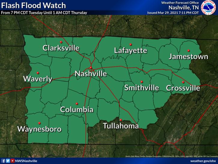
A graphic from NWS Nashville showing a flash flood watch for counties in central Tennessee on March … [+]
National Weather Service
Heavy thunderstorms could cause flash flooding this week across parts of Tennessee still struggling to recover from the awful storms and flooding the region experienced this past weekend. The ground is saturated enough across Tennessee, Arkansas, and Mississippi that it won’t take much heavy rain to trigger flash flooding.
A strong cold front sweeping down the Plains will reach the Mid-South by Tuesday. The front will move into a warm and humid environment, providing the lift and instability needed to fuel thunderstorms on Tuesday and Wednesday.
Some of the storms could be severe with damaging wind gusts, large hail, and isolated tornadoes possible. The Storm Prediction Center’s forecast for Tuesday calls for a marginal risk for severe thunderstorms across much of the lower Mississippi Valley.

The WPC’s forecast for the risk for excessive rainfall that could cause flash flooding on March 30, … [+]
NOAA/WPC
Winds and hail won’t be the only threat those storms pose. High moisture and slow-moving thunderstorms could set the stage for more flash flooding. The Weather Prediction Center’s latest excessive rainfall outlook for Tuesday shows a slight risk for flash flooding in southern Arkansas, northern Mississippi, and the western half of Tennessee. The threat for flooding will continue through Wednesday.

A map of observed precipitation totals between March 22, 2021, and March 29, 2021.
Data: NWS | Map: Dennis Mersereau
Some parts of the Mid-South witnessed an extreme rainfall event when thunderstorms repeatedly moved over the same areas on Saturday night. Communities south of Nashville recorded double-digit rainfall totals during the seven days between March 22 and March 29, the bulk of which fell in Saturday’s storms. A large swath of Tennessee has seen at least half a foot of rain in the last week.
Given the intense storms the region experienced this past weekend, it won’t take much heavy rain from this week’s storms to trigger flash flooding. The latest flash flood guidance indicates that it would only take one or two inches of rain falling over the course of a couple of hours to lead to flash flooding on roadways and waterways across the affected areas. The National Weather Service issued flash flood watches for the central part of Tennessee, including the Nashville metro area, in anticipation of more heavy rain from the approaching thunderstorms.
The majority of flood-related deaths in the United States occur in vehicles. The National Weather Service’s flood safety campaign is called “turn around, don’t drown” for good reason. It can take as little as one foot of moving water to lift up a vehicle and carry it downstream. It’s almost impossible to tell how deep the water is before you’re already in the water and it’s too late, and it’s even harder to tell if the road is still there or if the floodwaters washed it away.
This article is auto-generated by Algorithm Source: www.forbes.com


